Description
The coastline of the East Riding is about 140 km in length and can conveniently be divided into three contrasting sections.
The high chalk cliffs of Flamborough Head form the northernmost section from Dulcey Dock to Bridlington. This stretch is very popular with visitors attracted by the spectacular cliff-top path and views of the breeding colonies of sea birds nesting on the 135-m high Bempton Cliffs.
A continuous beach, backed by 10 to 30-m high cliffs forms the middle section from Bridlington to Spurn Head. The cliffs, composed of glacial till (boulder clay), are continually being undercut by rapid erosion, which is only temporarily slowed down at the "hard points" of the sea walls of Hornsea and Withernsea.
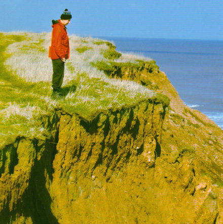
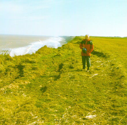
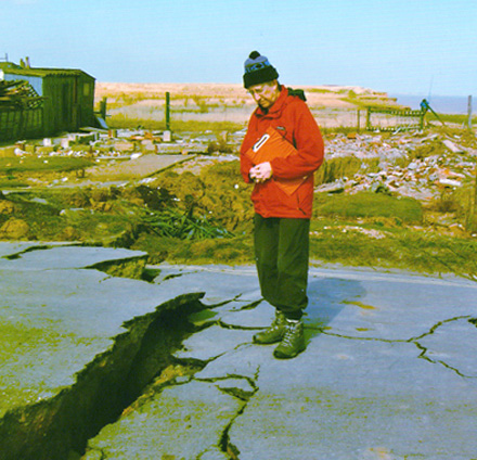
This section lacks an ongoing coastal path with a public right of way, although there is de facto access along well-trodden paths on the cliff top. The creation of an ongoing coastal path would be difficult, because of rapid coastal erosion, unless a coastal corridor were created. Even though it is possible, at low tide, to walk along the whole length of the shore, access points to the shore are infrequent, possibly because the high cliffs are constantly being undercut by erosion.
The Humber estuary forms the third section from the tip of Spurn Head to the Humber Bridge at Hessle, which is the first crossing point of the Humber for pedestrians. The next crossing point is at Goole, about 30 km up river. Apart from Spurn Head itself, the coast of the estuary is infrequently visited. In spite of this, a de facto coastal path exists along the whole section. The courtesy path along Sunk Island and the 2-km stretch from Kilnsea to the CP near Lockham are the only stretches that are not rights of way. From Stone Creel to Paull the path is atop the man-made earth bank, which forms the coastal defence. There a detour around the chemical works at Salt End, but from King George Dock to Hessle the route follows the Trans-Pennine Way, which continues further up the estuary. The creation of a corridor wider than about 20 m is probably impracticable along this section.